OpenStreetMap (OSM) is the Wikipedia of maps — a free, editable map of the world built entirely by volunteers. I have been contributing since April 2020, with a focus on mapping trails, roads, and places in the Indian Himalayas and other areas I have travelled through.
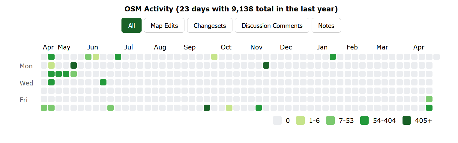
By the numbers
Stats as of April 2026, sourced from How did you contribute to OpenStreetMap?
| Member since | April 2020 |
| Mapping days | 250 |
| Total map changes | 253,458 |
| Changesets | 1,118 |
| Nodes created | 193,480 |
| Ways created | 8,161 |
| Countries mapped | 13 |
| Rank in India | #580 |
Where I map
The bulk of my contributions — over 251,000 changes — are in India, with a particular focus on the Kullu valley and surrounding areas in Himachal Pradesh, where I live. I have also mapped in Nepal, Germany, Sweden, Spain, Portugal, France, and several other countries visited during my bicycle expeditions.
My primary activity area covers the Kullu valley — trails, roads, villages, natural features, and infrastructure that are often missing or incomplete on commercial maps.
What I map
Most of my edits focus on:
- Trails and mountain paths — particularly high-altitude routes in Himachal Pradesh that are essential for trekkers and locals but absent from most maps
- Roads and highways — surface tagging, connectivity, and accuracy in remote areas
- Places and amenities — villages, water sources, shelters, and points of interest
- Natural features — rivers, peaks, landuse, and terrain
How I map
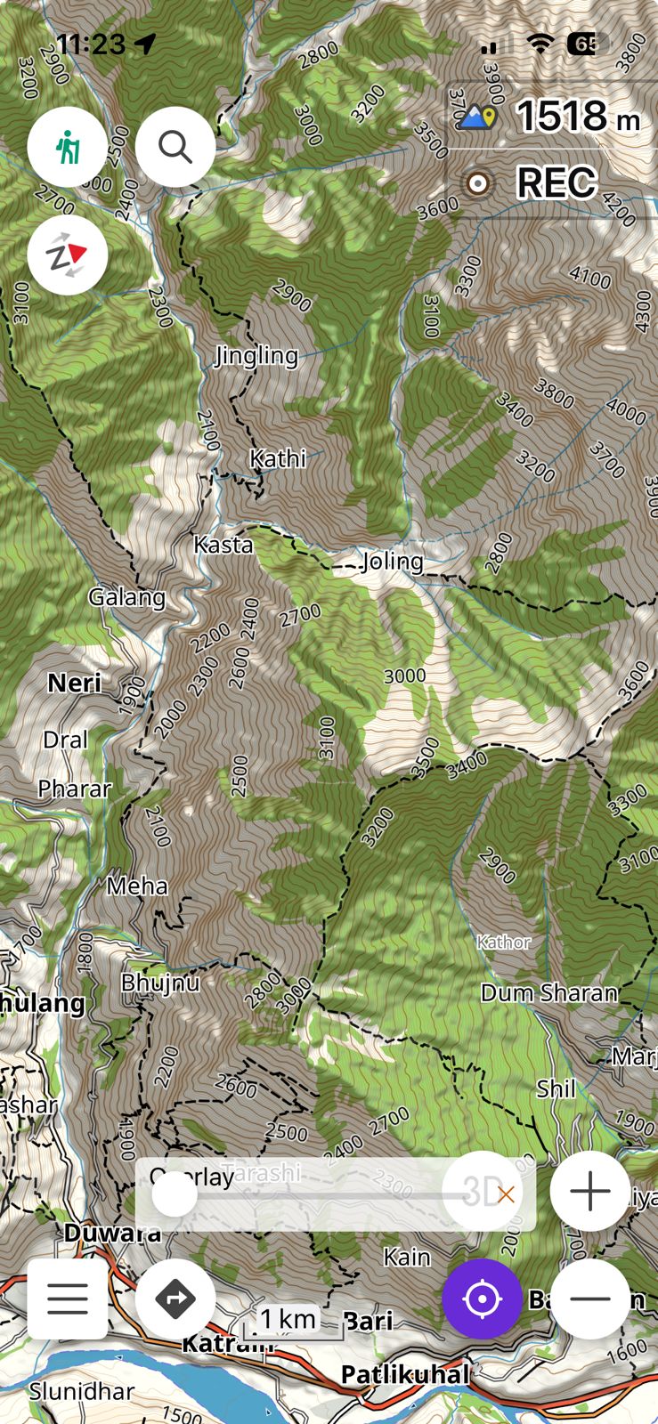
I map in two ways — as an armchair mapper and as a self-recorder in the field.
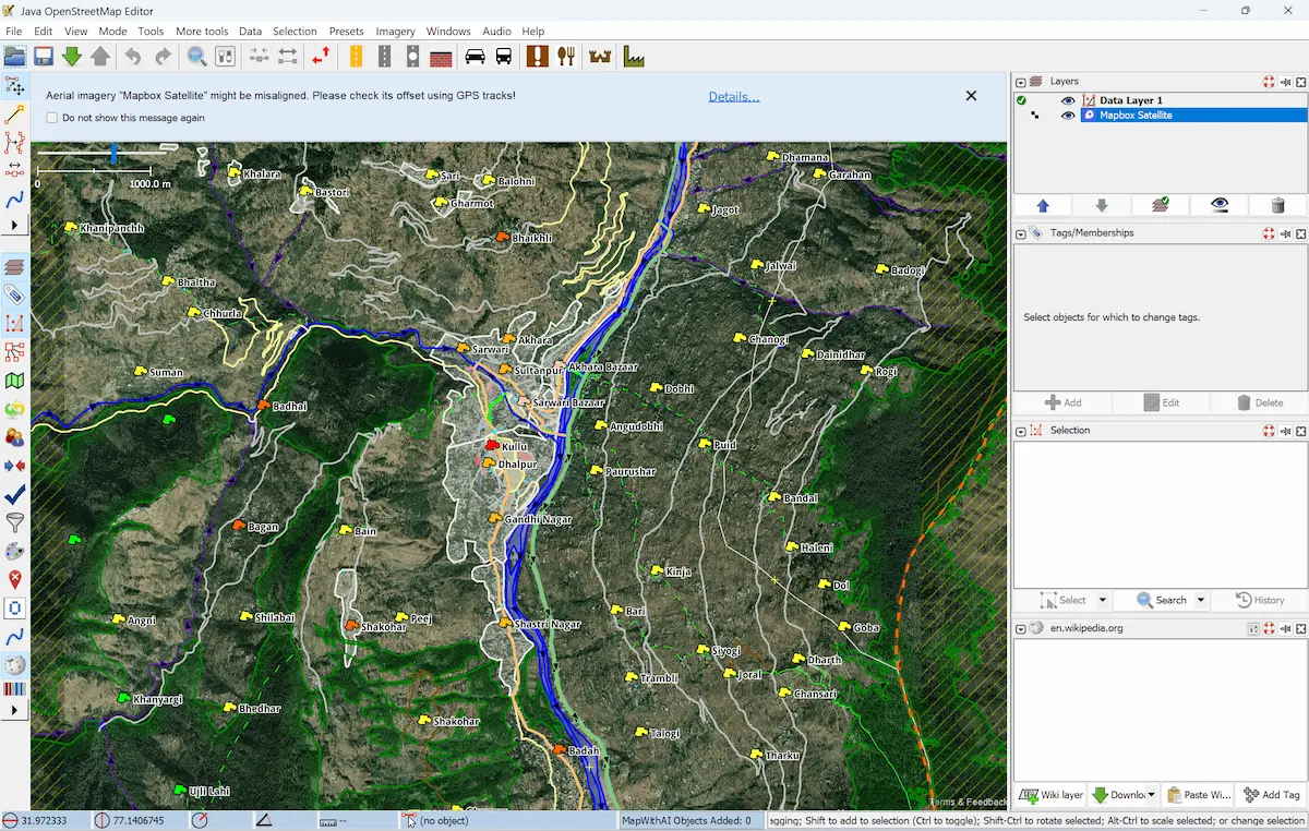
Armchair mapping means editing from a desk using openly available data sources rather than personal surveys. For this I rely on a combination of:
- Satellite imagery — openly licensed imagery from ESRI and Microsoft available directly within OSM editors, useful for tracing roads, buildings, and landuse
- Survey of India maps — particularly useful for names and locations of villages, rivers, and peaks in India. Two excellent sources are the SOI sheet index and the SOI data archive
- PMGSY road data — the Pradhan Mantri Gram Sadak Yojana database of rural roads, which I have worked on integrating into OSM. See my PMGSY-OSM integration project on GitHub
- Public GPS traces — recordings uploaded by other OSM contributors, available on the OSM traces portal, which help verify road alignments and trail routes in areas with poor imagery
Field recording means going out with a GPS device and recording tracks directly on trails and roads I travel through — on foot, by bicycle, or by other means. These traces then become the basis for accurate trail mapping, particularly in high-altitude areas where satellite imagery resolution is poor and existing data is sparse.
Tools
I primarily use:
- JOSM — a powerful desktop editor, my main tool for complex edits (623 changesets)
- Go Map!! — an iOS editor for on-the-go mapping (396 changesets)
- OsmAnd — for navigation and recording GPS traces in the field (56 changesets)
- iD editor — the browser-based editor for quick edits (43 changesets)
Get involved
If you’re interested in contributing to OpenStreetMap — particularly in mapping the Himalayas — feel free to reach out. The #kulluosm community is always looking for more mappers.